
Ordnance Survey Benchmarks
Here's the place to start your education on one aspect of UK map making.
Look and learn.
In the Begining ...
The Ordnance Survey as an organisation dates back to 21st June 1791, the day that the Master General of the Board of Ordnance (Charles Lennox, the 3rd Duke of Richmond) paid Jesse Ramsden for a new state-of-the-art theodolite (telescope on a protractor). Thus started the process of covering the UK mainland with a process of triangulation, from which a new era of accurate maps commenced.
... Then ...
But it wasn't until 1841 that the national surveys started to provide more accurate measurement of the height of the land, using spirit-levelling (telescope on a spirit level with a staff i.e. vertical ruler). Crucial information essential to accurate maps. From then until around 1972 the Ordnance Survey developed and maintained a network of around 750,000 local marks - benchmarks - that acted as a datum from which local height surveys could be undertaken to support map-making, engineering and building projects. By 1972 the Ordnance Survey stopped maintaining the network and by the mid 1980's resurveys of benchmarks stopped.
... and Now
In 2000 the OS switched from using levelling to the use of GPS for measuring heights. There are probably around 500,000 benchmarks that survive, but despite a band of enthusiasts no-one knows how many remain. A set of circa 200 Fundamental Benchmarks is maintained along with around 100 permanent GPS sites.
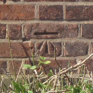
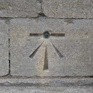
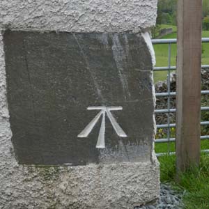
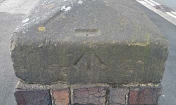
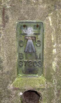
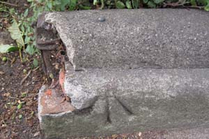
Anyway, the original benchmarks come in a variety of types as well as the common cut-mark, as can be seen from the selction here.
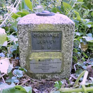
Start here at the Ordnance Survey if you want to find out where they all are, some already gone, some like this one still clinging on.
And if you get all enthusiastic then go to bench-marks.org for in-depth information.
So, when you are out and about, keep a lookout and think about the role they've played and the effort put into creating and measuring them.